How it works
the conversation
Every map project begins with a conversation. This can be a phone call by the client, or the result of a quote request. This helps to define the purpose of the map, the target audience, and how best to convey the information to the reader. During this call, we discuss the basics of the project. This includes:
- The subject of the map (what it’s about)
- The area of coverage
- Final use of the map (book, magazine, etc.)
- Size and file format needed
- Visual style
- Color or black-and-white
- Deadline

Phones used to look like this. Really.
With this information, I give the client a price quote. This is usually a range, such as $500 to $700. This allows for adjustments based on the complexity of the project, or additions to the original specifications. The quote is sent to the client in writing, along with other terms of the agreement, such as copyright, revisions, and delivery schedule. Once the client agrees, the work begins.
Collecting the data
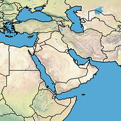
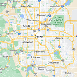
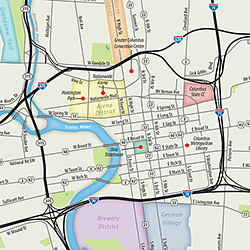
The first step is establishing the area of coverage. Depending on the map, I’ll use a simplified map of the world for large areas, or a Google map screenshot for small areas, like the examples shown here. I'll send this to the client to make sure the coverage area is correct.
Once the area is set, I begin collecting the specialized data used to create the map. I use open-source data to eliminate any copyright issues. This data allows me to show whatever the map requires—everything from roads, cities, and parks to geographic features, environmental issues such as land use or pollution—just about anything that can be measured. I categorize and sort this data so I can work with it in later steps of the production process.
Manipulating the data
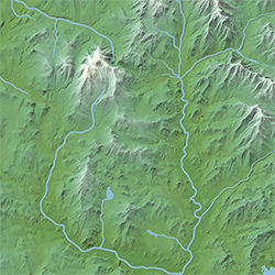
Once I've gathered all of the data for the project, I bring it into special software called GIS which allows me to manipulate it. For example, I usually separate roads into highways, major roads, and minor roads. This allows me to style them differently. I can also change the projection of the map as needed to suit the goals of the client. Here are two different projections of a US map. Decisions such as the projection are made in consultation with the client; if there's a choice to be made, I'll explain the options to the client and give my recommendation, but the final decision is always up to the client.
At each stage of the project, I send proofs to the client for their review and approval.
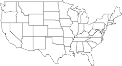
USA - Mercator Projection
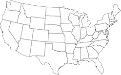
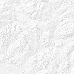
USA - Albers Equal Area Projection
Creating the visual style
Once the data is ready, I move it from the GIS software into graphic design software, where I determine how things will look. For example, highways, major roads, and minor roads will be shown differently to allow the reader to quickly understand the information. Many visual styles are possible; I can match the style of your other graphics or a corporate style guide. I use industry-standard software such as Adobe Illustrator and Photoshop to ensure maximum compatibility with any publishing system, and the final files can be supplied in any desired format.
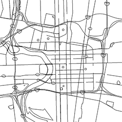
Here's what the raw data looks like.
The same data after graphic enhancement.
Adding terrain
Maps are often enhanced by showing the terrain of the area, such as mountains, valleys, and other geological features. If the map includes shaded relief terrain, I’ll add it at this stage. Terrain can be represented in several ways — realistically, stylized, or single color.
Adding special features
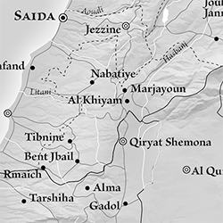
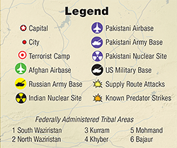
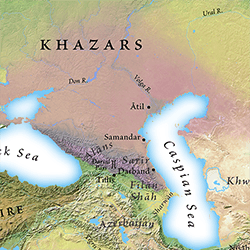
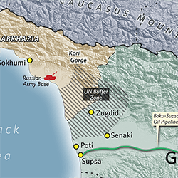
For some maps, general areas need to be depicted, such as areas of territorial control by different groups. Since these are often not well delineated, I can show them with imprecise borders if desired. Maps with a number of such areas can be shown in several ways, such as different colors or patterns.
Labels and final touches
Finally, once all of the map features are done, text labels are added. Most maps also include a legend and map scale. Tourism maps have special requirements. Points of interest need to be highlighted, as well as shops and restaurants. These locations are listed in an indexed guide.
The final product can be supplied in any format (usually a print-ready PDF). I can also supply layered Illustrator or Photoshop files to enable the client to make changes.