Case Study
History of Islam Map Series
Requirement
The client was a London-based publisher specializing in books about the Islamic world. Three books were planned, each covering a different historical period. Over thirty color maps were needed to show several things: the growth of Islam over time, the areas of control by different groups and empires, and special features, such as trade routes.
Solution
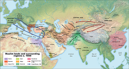
The client supplied text descriptions of each map, along with reference materials from several sources. These graphics included maps (such as those shown here), but these disagreed about many factors, including areas of control. In consultation with the client, I arrived at a final representation for each map.
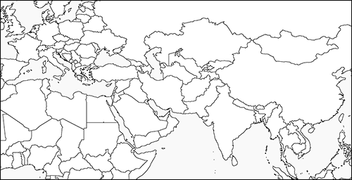
I created an initial version of each map in black and white, showing the areas and other features. The client’s input was essential at this stage to ensure that the maps presented correct information.
Unlike most maps, this project didn't require any data such as roads or national borders. Some ancient cities were included; since some of these no longer exist, this required close collaboration with the client to ensure their correct placement.
Once the information was confirmed, I created the final version of each map. It was important for all of the maps to have a consistent visual style, including type and colors. Because these maps covered a large area, it was useful to include terrain. I chose a realistic depiction of terrain, since the final product was intended primarily for educational use.
Result
The final maps were supplied to the client, both as PDFs in the exact sizes needed for final production, and layered Adobe Illustrator files. Also, the client had requested black-and-white versions of each map to be used as teacher guides, plus of version of each map suitable for use in PowerPoint slides.
Area of coverage
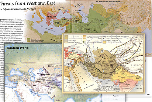
Reference materials
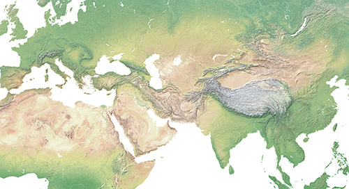
Terrain layer